Photo Album GPS Mapping Tool
By Reverse Engineering Consultants, LLC
Did you know that photos taken by
Phones and Tablets often include the GPS coordinates where the photo was taken?
These location markers are stored in the photos ‘Metadata’. Now you can extract these locations from all
your photo albums and view this data on a google earth style map with the Photo
Album GPS Mapping Tool Software!
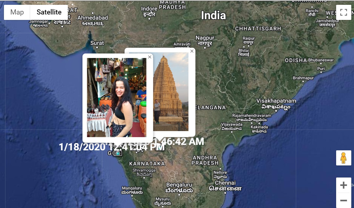

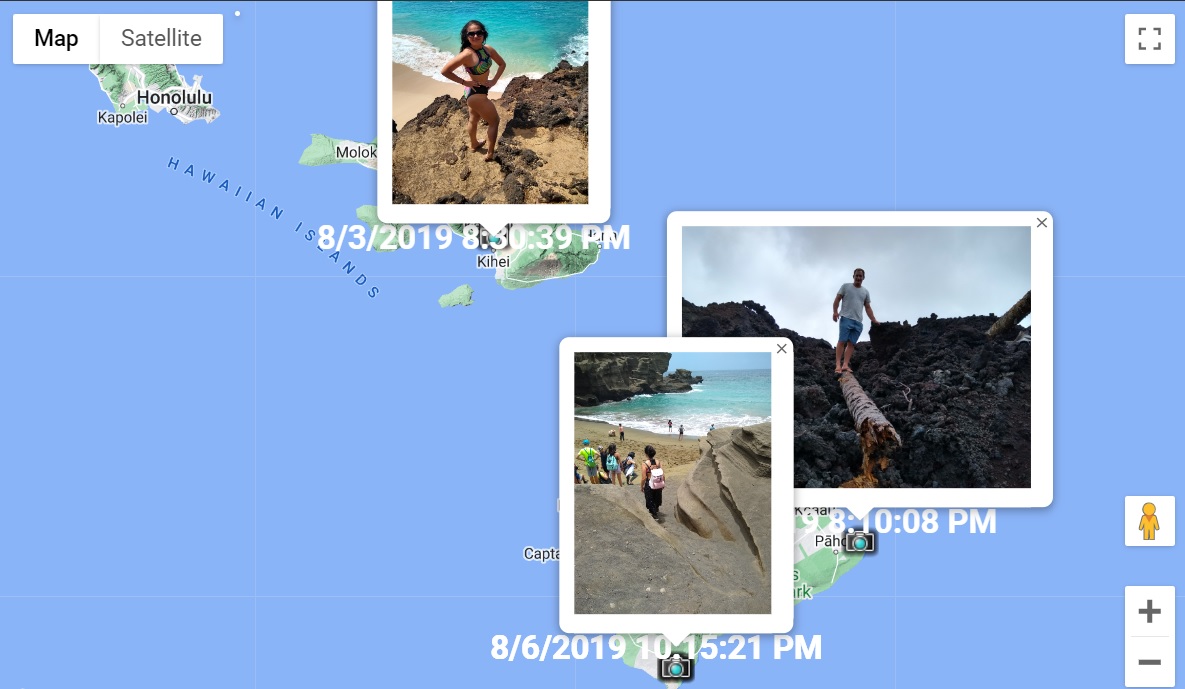
Now you can look back on all your
adventures, seeing exactly where you were when the pictures were taken. You
can also use the Photo Album GPS Mapping Tool to add 'geotags' to your photos.
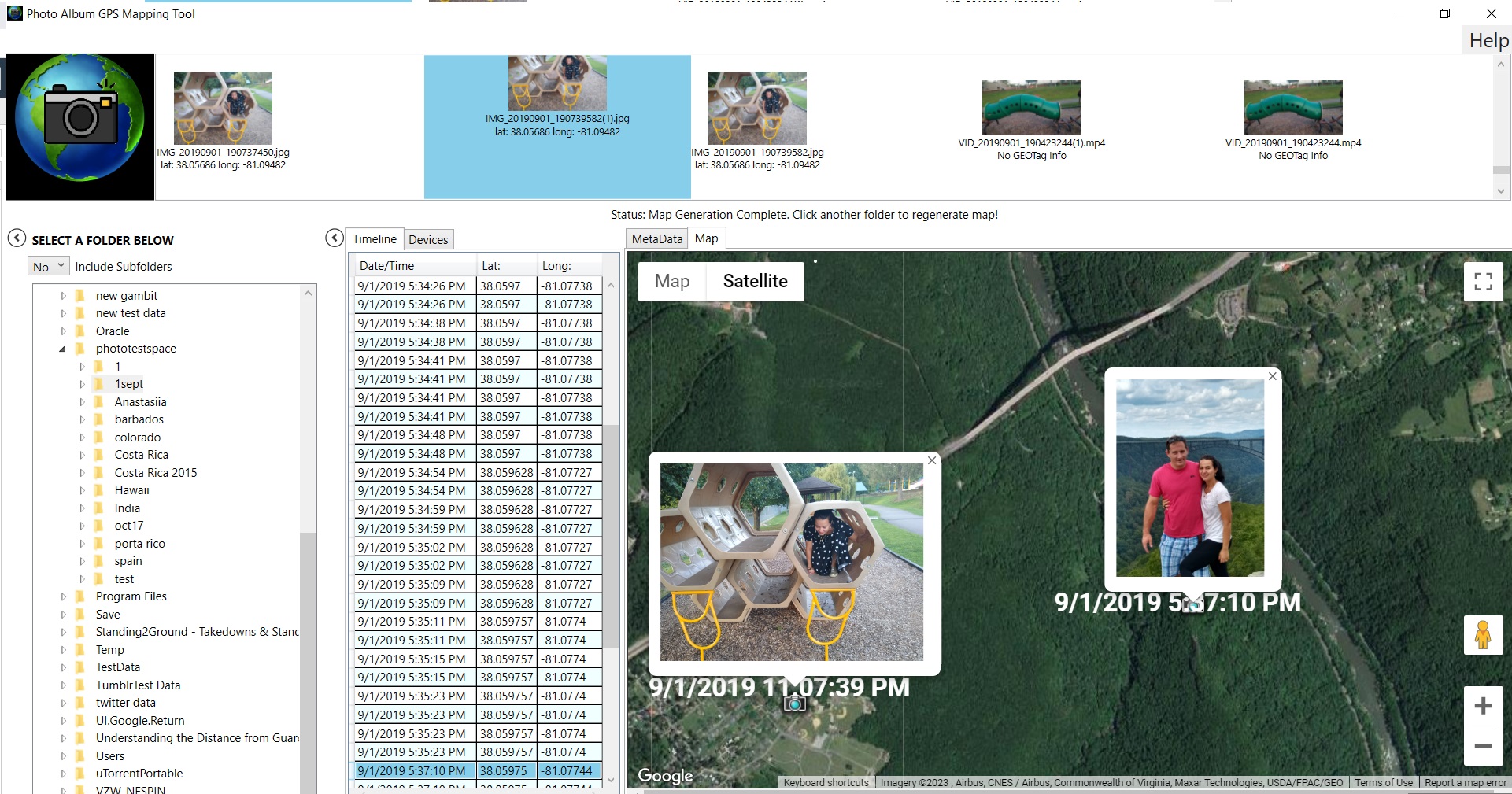
The Photo Album GPS Mapping Tool
organizes your photos in three separate ways. A timeline view allows you to see
your photos chronologically. The Device View organizes the files by the device that
took the photo, and a thumbnail view allows you to view the photos visually. Clicking
on any view will generate a map for that photo. Multiple photos can also be selected to
generate a map with multiple location points. Once the map is generated, click on the placemarks
to see the photo on the map.
The Photo Album GPS Mapping Tool now allows
you to add your own geotags to photos without them or you can also edit the location and timestamp
information of existing geotags.
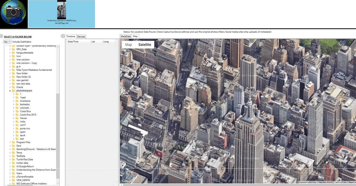
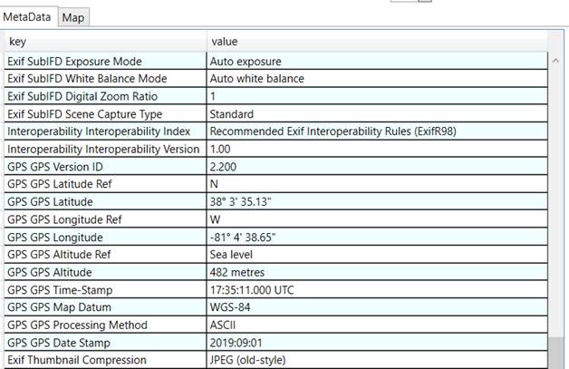
For advanced users, Photo Album GPS
Mapping Tool also list all the metadata attached to each photo.
Download the Photo Album GPS Mapping
Tool now and try it for free!
Reverse Engineering Consultants, LLC